
Afan Forest Park – Glyncorrwg Mountain Bike Centre, near Port Talbot
Starting point for waymarked mountain bike trails
The following mountain bike trails are diverted:
Afan Forest Park Visitor Centre is the main starting point for walking and mountain bike trails in Afan Forest Park.
The mountain bike trails range from easy trails for families and beginners to trails for experienced riders, and there is a skills park for less experienced riders.
The walking trails range from a short level route along a former trackway to a strenuous walk along a ridgetop with panoramic views.
The car park and visitor centre are managed by Neath Port Talbot Council.
The walking trails are waymarked from start to finish.
Look out for the information panel at the start of the trail.
Find out about walking trail grades.
The Old Parish Road Walk follows part of the ancient trackway that was the main means of transport in the valley until it fell into disuse in 1920.
The walk returns to the visitor centre along a former railway line.
The River and Railway Walk descends into the valley and crosses the River Afan before climbing steeply to the old railway line.
It passes a sealed railway tunnel entrance which was designed and built by Brunel.
The Gyfylchi Ridgetop Trail crosses the River Afan and climbs through woodlands to the hilltop.
There are panoramic views of the valley.
The trail then goes past two sets of ruins – Nant-y-bar farm and the 18th century Gyfylchi chapel, once a shrine to Welsh Methodism – before it descends to the car park.
All our mountain bike trails are waymarked from start to finish and have been graded for difficulty.
At the start of the trail there is an information panel – please read this before setting off.
This green-graded trail is a fun, winding, and flowing trail.
It is a perfect introductory route for newcomers, with a wide trail and slightly sweeping declines.
There is a skills park on the trail which offers riders the opportunity to develop their technical riding abilities too.
The optional 2.4 kilometre blue-graded loop provides a taster for those wishing to progress; it drops down to the River Afan and exposes some secret spots.
Picnic areas can be found along the trail.
Accessibility information
This trail is suitable for people using adaptive equipment.
Adaptive equipment includes adaptive cycles, adaptive wheelchairs and mobility scooters.
We have produced a film about this trail to help you work out how suitable it may be for you before you visit.
To watch the film, go to Trails for users of adaptive equipment
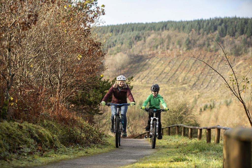
This gentle trail follows the wide, flat route of an old railway track that once carried passengers and coal the length of the valley.
On over 14 kilometres of disused railway and forest roads this trail connects the communities of Pont-rhyd-y-fen and Glyncorrwg - a great way to explore the Afan Valley.
The Blue Scar moderate-graded trail is designed as a progression for riders who are very competent on green-graded trails and want to start trying more remote and challenging routes.
Watch out for steeper sections that may challenge you but will help you develop your skills and confidence.
All in all, a fantastic trail to progress your riding and introduce you to the real Afan mountain bike trail network.
Accessibility information
This trail is suitable for people using adaptive equipment.
Adaptive equipment includes adaptive cycles, adaptive wheelchairs and mobility scooters.
We have produced a film about this trail to help you work out how suitable it may be for you before you visit.
To watch the film, go to Trails for users of adaptive equipment
This classic South Wales trail is designed to be a progression to the more demanding Afan trails.
It climbs out from the visitor centre car park to give a stunning trail, mixing the old with the new.
Enjoy the combination of forest road climbs with some fantastic views, and flowing singletrack descents, plus some steeper sections in the mix.
This trail can be demanding for less experienced riders and is exposed to bad weather on the higher ground.
Boasting some of the best singletrack descents in the UK, this trail traverses the north side of the Afan Valley.
It varies from fast, open and flowing to tight, technical and rooty.
Great views of the valley and coastline open out at different points, and in places the steep-sided slopes can feel exposed.
Afan Forest Park Visitor Centre is situated in Afan Forest Park.
Afan Forest Park is one of Britain’s iconic mountain bike destinations and a popular place for walking.
The forest park is situated in the Afan Valley, a former coal mining valley just a few miles from the M4, and you can discover some of the valley’s heritage features along our trails.
Explore Afan Forest Park from these other car parks:
We want you to return home safely after your visit here.
You are responsible for your own safety as well as the safety of any children and animals with you during your visit.
For advice and tips to help you plan your visit here go to Visiting our places safely.
The Rookie and the Blue Scar mountain bike trails are suitable for people using adaptive equipment.
Adaptive equipment includes adaptive cycles, adaptive wheelchairs and mobility scooters.
We have produced a film about each of these trails to help you work out how suitable they may be for you before you visit.
To watch the films, go to Trails for users of adaptive equipment
The car park, toilets and all visitor facilities here are managed by Neath Port Talbot Council.
For more information and opening times go to the Afan Forest Park Visitor Centre website.
See the top of this webpage for details of any planned closures or other changes to the trails here.
For your safety, always follow instructions from staff and signs including those for trail diversions or closures.
We may divert or close trails whilst we undertake maintenance work or other operations and we may need to close other visitor facilities temporarily.
In extreme weather, we may close facilities at short notice due to the risk of injury to visitors and staff.
You may need permission from us to organise an event or to carry out some activities on our land.
Check if you are allowed to use our land.
We recommend you follow these directions or use the Google map below which has a pin on this place’s location.
Afan Forest Park Visitor Centre is 5½ miles north east of Port Talbot.
Exit M4 at junction 40 for Port Talbot and follow signs onto A4107 towards Cymer.
Follow the brown and white signs for Afan Forest Park from the roundabout.
The visitor centre car park will be on the right, approximately 6 miles from the motorway junction.
The Ordnance Survey (OS) grid reference for the car park is SS 820 950 (Explorer Map 165 or 166).
The postcode is SA13 3HG. Please note that this postcode covers a wide area and will not take you directly to the entrance.
Sustrans National Cycle Network route 887 goes to Afan Forest Park. For more information go to the Sustrans website.
View this place on the What3Words website.
The nearest mainline railway station is in Port Talbot.
For details of public transport go to the Traveline Cymru website.
The car park is managed by Neath Port Talbot Council.
For more information and opening times go to the Afan Forest Park Visitor Centre website.
The car park, toilets and some visitor facilities here are managed by Neath Port Talbot Council. For more information and opening times go to the Afan Forest Park Visitor Centre website.
There are no Natural Resources Wales staff at this location. Contact our customer team for general enquiries during office hours, Monday to Friday.


