
Beddgelert Forest, near Beddgelert
Huge forest in the heart of Eryri National Park
All the walking trails here are closed.
There are hazardous tree felling operations ongoing in this woodland. Please obey all signage and instructions on site.
Sawbench is the starting point for two walking trails and two red graded mountain bike trails.
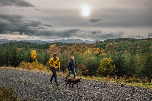
The walking trails take in historical features and views over the Conwy Valley and Llanrwst.
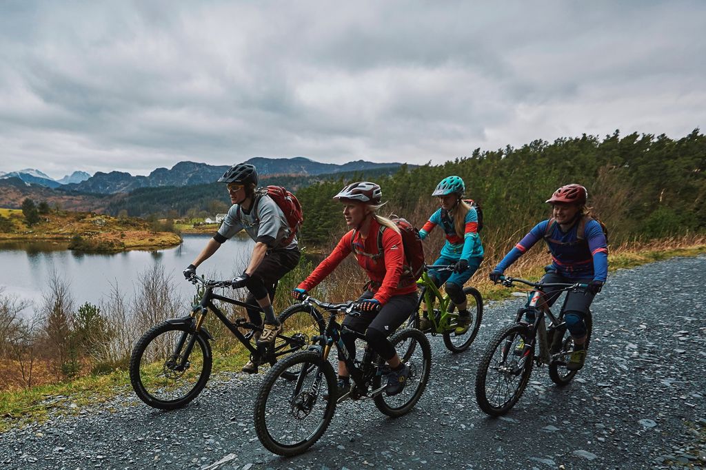
The mountain bike trails are the classic Gwydir Mawr and a shorter, bitesize option called Gwydir Bach.
The walking trails are waymarked from start to finish.
Look out for the information panel at the start of the trail.
Find out about walking trail grades.
This short historical walk has several viewpoints giving glimpses of the old market town of Llanrwst.
The walk is named after one of two Lady Marys from the Wynn family who bought the land and built up the historic Gwydir Estate.
The walk takes in two sculptures by local artists, one of which is a memorial to the old Llanrwst Town Hall.

This walk offers stunning views along the Conwy Valley before climbing over the hill to a viewpoint overlooking the dramatic mountains to the west.
On the route back to the car park you walk past Caerdroia, a community-managed woodland, which you can walk around and read the information panels explaining the work of the group.
You will also pass several sculptures by local artists, telling the stories that link the forest and the town of Llanwrst.
Listen to the story of Lady Mary from the Wynn family who bought the land and built up the Gwydir Estate.
The audio trail has been designed to be used along the Lady Mary’s Walk, a waymarked walking route from Sawbench car park.
We recommend that you download the audio trail to your smartphone before your visit as mobile network coverage can be limited in rural areas.
You can also download a PDF file of the audio trail’s script from the downloads section at the bottom of this page.
All our mountain bike trails are waymarked from start to finish and have been graded for difficulty.
At the start of the trail there is an information panel – please read this before setting off.
Gwydir Bach is the little sister to its bigger brother, Gwydir Mawr.
Two big climbs earn you arguably the best descents of the whole trail, all wrapped up in one easy to digest, bitesize chunk.
Gwydir Mawr is one of the original mountain bike trails and is a true classic.
Big climbs, big descents, brilliant singletrack and truly awesome scenery make this a trail to remember.
Now including a brand new two kilometre section with a mix of traditional hand dug trail and modern flow trail features.
You can also start Gwydir Mawr from Hafna car park.

Sawbench is in Gwydir Forest Park.
Gwydir Forest Park lies in the heart of the Eryri National Park and encircles the village of Betws-y-coed.
Lead and zinc mining once dominated the area and the legacy of old engine-houses, waste tips and reservoirs are characteristic features of the forest landscape today.
Several of the most important mines have been partially restored and made safe for visitors.
Waymarked trails start from Betws-y-coed and several other Natural Resources Wales car parks in Gwydir Forest Park:
Gwydir Forest Park is set in Eryri National Park.
Eryri is the largest National Park in Wales and is home to picturesque towns and villages and the highest mountain in Wales.
It is looked after by the Eryri National Park Authority.
For more information about visiting Eryri go to the Eryri National Park Authority website.
We want you to return home safely after your visit here.
You are responsible for your own safety as well as the safety of any children and animals with you during your visit.
For advice and tips to help you plan your visit here go to Visiting our places safely.
See the top of this webpage for details of any planned closures or other changes to visitor facilities here.
For your safety, always follow instructions from staff and signs including those for trail diversions or closures.
We may divert or close trails whilst we undertake maintenance work or other operations and we may need to close other visitor facilities temporarily.
In extreme weather, we may close facilities at short notice due to the risk of injury to visitors and staff.
You may need permission from us to organise an event or to carry out some activities on our land.
Check if you are allowed to use our land.
We recommend you follow these directions or use the Google map below which has a pin on this place’s location.
Sawbench is 1 mile west of Llanrwst.
Take the B5106 from Llanrwst towards Betws-y-coed.
After turning left at the brown and white sign for Gwydir Castle, turn immediately right onto a minor road.
Take the first forest road on the left signposted Mainc Llifio/Sawbench.
The Ordnance Survey (OS) grid reference for the car park is SH 789 609 (Explorer Map OL 17).
The postcode is LL26 0PN. Please note that this postcode covers a wide area and will not take you directly to the entrance.
View this place on the What3Words website.
The nearest mainline railway station is in Llanrwst.
For details of public transport go to the Traveline Cymru website.
Parking is free of charge.
Overnight parking is not permitted.
There are no staff at this location.
Contact our customer team for general enquiries during office hours, Monday to Friday.


