
Beddgelert Forest, near Beddgelert
Huge forest in the heart of Eryri National Park
Glasdir is in Coed y Brenin Forest Park.
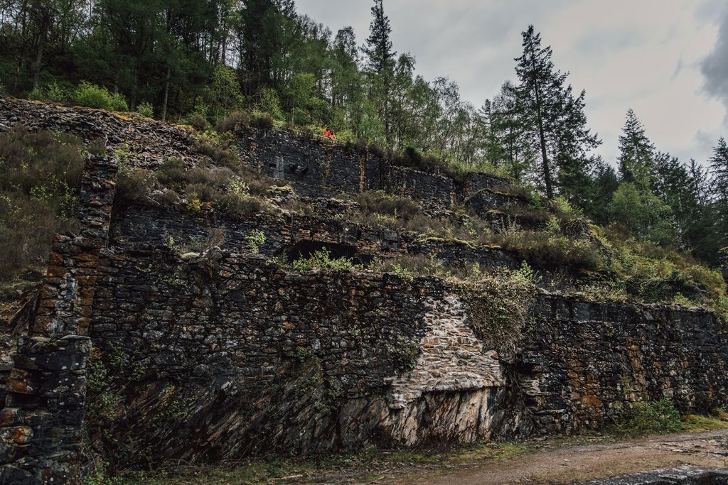
The car park is the starting point for a walk through an old copper mine.
There is a picnic site with barbecue by the side of the river.
There is a shorter accessible walking trail to a viewpoint over the mine from the Pont Llam yr Ewig car park.
The walking trail is waymarked from start to finish.
Look out for the information panel at the start of the trail.
Find out about walking trail grades.
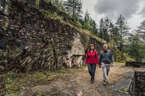
Follow the red waymarkers from the Glasdir car park through the picnic site down to the river Babi.
The trail takes in a circuit of the old copper mine set into the hillside in a series of high stone terraces.
You can download an audio trail and listen to the history of the Glasdir copper mine.
Learn about the history of the Glasdir copper mine on our audio trail.
The audio trail has been designed to be used along the Glasdir Copper Trail, a waymarked walking route from Glasdir car park.
We recommend that you download the audio trail to your smartphone before your visit as mobile network coverage can be limited in rural areas.
You can also download a PDF file of the audio trail’s script from the downloads section at the bottom of this page.
The main car parks with facilities for visitors within Coed y Brenin Forest Park are:
Coed y Brenin Forest Park is set in Eryri National Park.
Eryri is the largest National Park in Wales and is home to picturesque towns and villages and the highest mountain in Wales.
It is looked after by the Eryri National Park Authority.
For more information about visiting Eryri go to the Eryri National Park Authority website.
We want you to return home safely after your visit here.
You are responsible for your own safety as well as the safety of any children and animals with you during your visit.
Please note:
For advice and tips to help you plan your visit here go to Visiting our places safely.
There is a shorter accessible walking trail to a viewpoint over the mine from the car park for disabled visitors at Pont Llam yr Ewig.
See the top of this webpage for details of any planned closures or other changes to visitor facilities here.
For your safety, always follow instructions from staff and signs including those for trail diversions or closures.
We may divert or close trails whilst we undertake maintenance work or other operations and we may need to close other visitor facilities temporarily.
In extreme weather, we may close facilities at short notice due to the risk of injury to visitors and staff.
You may need permission from us to organise an event or to carry out some activities on our land.
Check if you are allowed to use our land.
We recommend you follow these directions or use the Google map below which has a pin on this place’s location.
Glasdir is 6 miles north of Dolgellau.
Take the A470 north from Dolgellau towards Porthmadog.
About 200 metres after passing the Tyn y Groes Hotel, turn right following the brown tourist signs to Ty'n y Groes.
Follow the tarmac road past the Ty’n y Groes picnic site for just over one kilometre.
The Glasdir car park is on the right with a picnic site a short walk away across the road.
The Ordnance Survey (OS) grid reference for the car park is SH 737 226 (Explorer Map OL 18).
The postcode is LL40 2NW. Please note that this postcode covers a wide area and will not take you directly to the entrance.
View this place on the What3Words website.
The nearest mainline railway stations are in Barmouth (Cambrian Coast line) and Blaenau Ffestiniog (Blaenau Ffestiniog-Llandudno line).
For details of public transport go to the Traveline Cymru website.
Parking is free of charge.
Overnight parking is not permitted.
There are no staff at this location.
Contact our customer team for general enquiries during office hours, Monday to Friday.


