
Beddgelert Forest, near Beddgelert
Huge forest in the heart of Eryri National Park
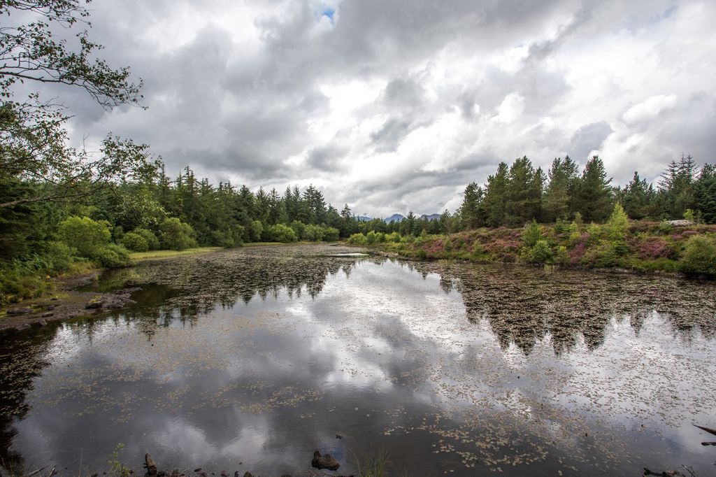
Llyn Sarnau means “lake of the old tracks” in Welsh and it is a lovely place for a picnic at one of the tables around the car park.
The lake is fairly shallow and so it often dries out in summer - even though it may not be much to look at during warmer months, it's a valuable home for wetland loving wildlife.
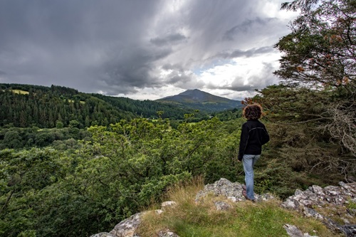
Discover beautiful mountain and valley views, scenic lakes and old disused lead mines on the walking trail.
There is a picnic table in the car park.
The walking trail is waymarked from start to finish.
Look out for the information panel at the start of the trail.
Find out about walking trail grades.
Head out from the car park and take your time to appreciate the view from the benches.
Reach a path that goes around then down the middle of a small lake.
Meander through the old High Hafna Mine, once a hive of industry, then continue along an undulating path through the woods, taking in a viewpoint on top of a cliff edge.
Facilities for visitors with disabilities at Llyn Sarnau include:
Llyn Sarnau is in Gwydir Forest Park.
Gwydir Forest Park lies in the heart of the Eryri National Park and encircles the village of Betws-y-coed.
Lead and zinc mining once dominated the area and the legacy of old engine-houses, waste tips and reservoirs are characteristic features of the forest landscape today.
Several of the most important mines have been partially restored and made safe for visitors.
Waymarked trails start from Betws-y-coed and several other Natural Resources Wales car parks in Gwydir Forest Park:
Gwydir Forest Park is set in Eryri National Park.
Eryri is the largest National Park in Wales and is home to picturesque towns and villages and the highest mountain in Wales.
It is looked after by the Eryri National Park Authority.
For more information about visiting Eryri go to the Eryri National Park Authority website.
We want you to return home safely after your visit here.
You are responsible for your own safety as well as the safety of any children and animals with you during your visit.
For advice and tips to help you plan your visit here go to Visiting our places safely.
See the top of this webpage for details of any planned closures or other changes to visitor facilities here.
For your safety, always follow instructions from staff and signs including those for trail diversions or closures.
We may divert or close trails whilst we undertake maintenance work or other operations and we may need to close other visitor facilities temporarily.
In extreme weather, we may close facilities at short notice due to the risk of injury to visitors and staff.
You may need permission from us to organise an event or to carry out some activities on our land.
Check if you are allowed to use our land.
We recommend you follow these directions or use the Google map below which has a pin on this place’s location.
Llyn Sarnau is 2 miles west of Llanrwst.
Take the B5106 from Llanrwst towards Betws-y-coed.
After turning left at the brown and white sign for Gwydir Castle, turn immediately right onto a minor road.
Go past the car parks for Sawbench and Hafna and the Llyn Sarnau car park is on the left.
The Ordnance Survey (OS) grid reference for the car park is SH 778 592 (Explorer Map OL 17).
The postcode is LL27 0JB. Please note that this postcode covers a wide area and will not take you directly to the entrance.
View this place on the What3Words website.
The nearest mainline railway station is in Llanrwst.
For details of public transport go to the Traveline Cymru website.
Parking is free of charge.
Overnight parking is not permitted.
There are no staff at this location.
Contact our customer team for general enquiries during office hours, Monday to Friday.


