
The Arch, near Aberystwyth
Walks through huge beech trees with views over...
Gogerddan Wood is a short drive from Aberystwyth and is easy-to-find.
The circular walking trail starts from the car park and the small picnic site is in a sheltered location by Nant Clarach stream.
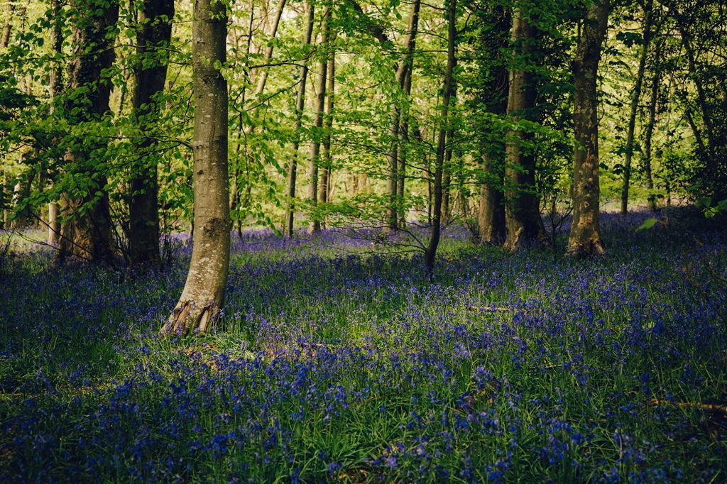
There is a stunning display of bluebells and other wildflowers in spring, and an array of seasonal colours in autumn.
The woodland has some beautiful old trees including oak, sweet chestnut and lime.
It gets its name from the nearby Plas Gogerddan (Gogerddan mansion), an old mansion owned by the Pryse family who were famous silver and lead mine owners.
The walking trail is waymarked from start to finish.
Look out for the information panel at the start of the trail.
Find out about walking trail grades.
The veteran trees and stunning spring flowers are the highlights on this pleasant walk with an amazing bluebell display in late spring.
It is a fairly short walk but the steep climbs through the trees are rewarded with some lovely views.

We want you to return home safely after your visit here.
You are responsible for your own safety as well as the safety of any children and animals with you during your visit.
For advice and tips to help you plan your visit here go to Visiting our places safely.
See the top of this webpage for details of any planned closures or other changes to visitor facilities here.
For your safety, always follow instructions from staff and signs including those for trail diversions or closures.
We may divert or close trails whilst we undertake maintenance work or other operations and we may need to close other visitor facilities temporarily.
In extreme weather, we may close facilities at short notice due to the risk of injury to visitors and staff.
You may need permission from us to organise an event or to carry out some activities on our land.
Check if you are allowed to use our land.
We recommend you follow these directions or use the Google map below which has a pin on this place’s location.
Gogerddan Wood is 3 miles north east of Aberystwyth.
Follow the A487 from Aberystwyth towards Machynlleth.
After 2½ miles, turn right for Penrhyncoch and continue straight over the crossroads.
In ½ mile, the car park is on the left, after passing the large greenhouses.
The Ordnance Survey (OS) grid reference for the car park is SN 634 837 (Explorer Map 213).
The postcode is SY23 3ED. Please note that this postcode covers a wide area and will not take you directly to the entrance.
View this place on the What3Words website.
The nearest mainline railway station is in Aberystwyth.
The bus service from Aberystwyth to Penrhyncoch stops at the Aberystwyth University entrance, very near to Gogerddan Wood car park.
For details of public transport go to the Traveline Cymru website.
Parking is free of charge.
Overnight parking is not permitted.
There are no staff at this location.
Contact our customer team for general enquiries during office hours, Monday to Friday.


