
The Arch, near Aberystwyth
Walks through huge beech trees with views over...
New ways to pay for parking from 30 March
From 30 March, payment for parking can be made by contactless at the machine in the car park (the machine will not take cash), on the RingGo website or on the RingGo app. New charges will apply every day from 6am to 11:59pm. Parking will be checked by cameras and a mobile parking attendant.
Temporary trail closures and diversions
The Ridgetop walking trail and all of our mountain biking, running and horse riding trails may be closed at any time during March due to tree felling. Please see the information in the car park and follow all signs and instructions. Go to the press release for more information.
General visitor information
The café and shop are no longer operating but there are portable toilets and a hot drink and cold food unit in the car park. The visitor centre is unstaffed and there is no first aid provision. Please come prepared for the activity you’re doing and be aware of what to do in an emergency. For information on the marketing exercise for future lease of the Visitor Centre, please see our Visitor Centre engagement pages.
This information is also available in Welsh (Cymraeg).
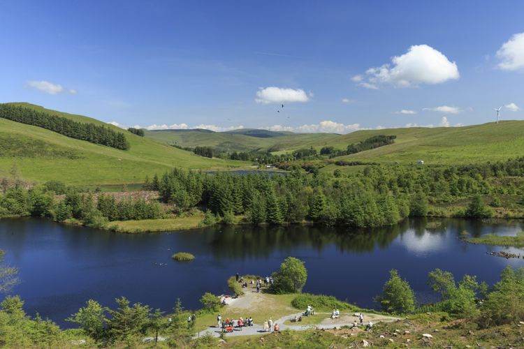
Bwlch Nant yr Arian Visitor Centre is well-known for its long-established tradition of feeding red kites every day.
There are waymarked trails for walkers, mountain bikers, runners and horse riders.
The skills park has a purpose-built track for mountain bikers to practice their technique.
Pay by card or cash at the ticket machine in the car park on arrival. The ticket machine does not give change.
These charges apply every day from 6am to 11:59pm:
Parking is free for Blue Badge holders but you must:
Overnight parking is not allowed for any vehicles. If you park between midnight and 6am you will get a parking charge notice.
You must pay for parking or register your vehicle for free parking by midnight on the day you visit.
You can do this:
A season ticket allows you to park between 6am and 11:59pm but does not reserve or guarantee a parking space.
A season ticket lasts for 12 months from the date you buy it.
There are two types of season ticket:
Up to 29 March you can buy a season ticket from our Customer Hub on 0300 065 3000.
From 30 March you can buy a season ticket:
Parking is checked by cameras and a mobile parking attendant.
You will get a parking charge notice from First Parking if you:
The parking charge is £100. There is a discounted rate of £60 if you pay within 14 days.
To appeal a parking charge notice, contact First Parking.
Do not contact us as it may cause a delay and mean extra costs to you.
The walking trails are waymarked from start to finish.
Look out for the information panel at the start of the trails.
Find out about walking trail grades.
‘Barcud coch' means red kite in Welsh and you will get the best view of the red kite feeding along this trail, either from inside the hide or at the viewpoint.
The trail goes around the lake - look out for the posts with facts about the red kite, and the sculptures and poetry which bring local folklore and history to life.
The Animal Puzzle Trail follows the same path - download an Animal Puzzle Trail leaflet from the bottom of this page and see how many animals you can find.
Follow the waymarkers down to an old mining leat and up the hill onto the ridgetop.
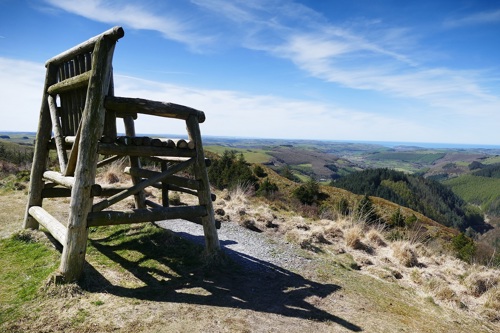
The Giant’s Chair is a great place to take in the view.
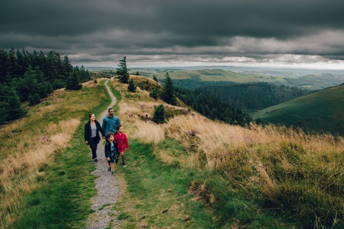
Follow the waymarkers up onto the heather clad ridge and enjoy the views of Cardigan Bay and the Cambrian Mountains.
Head past the stone viewpoint before dropping down through the trees and then joining the narrow path back to the car park.
The mountain bike trails start from the car park.
All our mountain bike trails are waymarked from start to finish and have been graded for difficulty.
At the start of the trail there is an information panel – please read this before setting off.

The Arian Trail is one for all the family to enjoy.
This forest road trail takes you to the picturesque Blaenmelindwr lake.
The Melindwr Trail is designed as a progression for riders who are competent riding blue grade trails to improve their skills before progressing to the next grade up.
Loop 1 has a forest road climb, a fine view and a super fun flowy descent with lots of berms.
Loop 2 goes up the beginning of ‘Italian Job’ before descending the 'Half Pipe' then climbing round 'The Nose' for a distant view to the sea. There is a long, flowing descent with fun rollers and berms before a climb up a forest road and the exciting final descent.
The Pendam Trail strings together some of the best flowing sections in Nant yr Arian with relatively short climbs.
With sections like ‘Italian Job’, ‘Hippity Hop’ and a fun final decent on ‘High as a Kite’.
Summit is the longer more challenging red-grade trail which weaves its way through the forest and takes you out onto the exposed moorland.
‘Mark of Zorro’ gives a fantastic long descent, well worth the following climb up the ‘Leg Burner’.
The Syfydrin Trail takes in all of the Summit Trail with its fantastic swooping, flowing singletrack, and adds to it by leading you out onto the high open hills with stunning views.
The skills park is a purpose-built track for mountain bikers to practice their technique or just warm up before hitting the longer trails which start from the visitor centre.
Features include rollers, step ups, berms, tabletops, hips and bowls.
It was designed and built by Trailcraft.
The waymarked running trails start from the car park.
Named after an imposing pair of Bronze Age local standing stones, Buwch a’r Llo (Cow and Calf), they are a fantastic introduction to trail running.
Please note:
This 5 kilometre trail starts off with a flat section for almost 2 kilometres before climbing up onto the ridge and back to the car park.
This challenging run follows Y Llo before crossing the road and passing a ruined farmstead.
Join the forest road which will take you past Syfydrin Lake then back past the ruin before climbing along the ridge to the car park.
This trail has steep ascents and descents and occasional sections of tarmac road.
The horse riding trail starts from a forest road near the visitor centre.
The trail is waymarked from start to finish.
Look out for the information panel at the start of the trail.
This waymarked trail is named after a local hill (Mynydd March or Horse Mountain).
There are stunning views over Cardigan Bay and Pumlumon Fawr, the highest mountain in mid Wales.
Please note:
There are four permanent orienteering courses (a series of posts you have to find in order).
These include an easier course for beginners and a harder course for experienced orienteers.
To get started:
Red kites are fed by the lake at Bwlch Nant yr Arian every day at 2pm.
There is no charge to watch the red kite feeding.
The red kite is a bird of prey with a reddish-brown body, angled wings and deeply forked tail.
You can expect to see as many as 150 red kites coming in to feed – there are often more during winter months. They swoop down to pick a piece of meat and eat on the wing.
Here are our tips for watching the red kite feeding:
There are two play areas, one for toddlers and one for older children.
All of the play equipment is of robust timber construction.
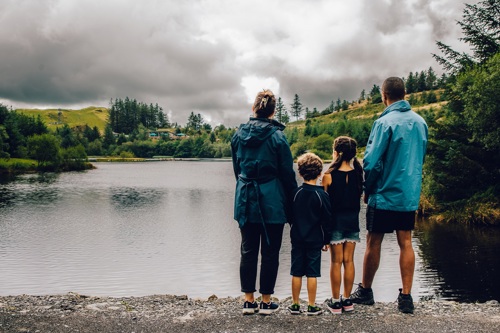
The Barcud Trail, which goes around the edge of the lake, is suitable for wheelchairs. There are no steps or stiles and the gradient is 10% or less with resting bays on uphill sections.
Other facilities include:
We welcome dogs at Bwlch Nant yr Arian.
You can take your dog with you when you use our walking, running and mountain bike trails but you must keep it on a lead or under close control.
Please pick up after your dog - you can dispose of the bagged poo in any refuse bin on site.
For a safe and happy visit with your dog, and to avoid causing problems for others, please follow the Dog Walking Code.
Please check the top of this page for any changes to the opening times:.
See the top of this page for details of any planned closures or other changes to visitor facilities.
We may divert or close trails whilst we undertake maintenance work or other operations and we may need to close other visitor facilities temporarily.
For your safety, always follow instructions from staff and signs including those for trail diversions or closures.
In extreme weather such as snow, ice or high winds:
We want you to return home safely after your visit here.
You are responsible for your own safety as well as the safety of any children and animals with you during your visit.
For advice and tips to help you plan your visit here go to Visiting our places safely.
You may need permission from us to organise an event or to carry out some activities on our land.
Check if you are allowed to use our land.
We recommend you follow these directions or use the Google map below which has a pin on this place’s location.
Bwlch Nant yr Arian Visitor Centre is 9 miles east of Aberystwyth.
Take the A44 from Aberystwyth towards Llangurig.
After 9 miles, the visitor centre car park is signposted on the left.
The Ordnance Survey (OS) grid reference for the car park is SN 718 812 (Explorer Map 213).
The postcode is SY23 3AB. Please note that this postcode covers a wide area and will not take you directly to the entrance.
View this place on the What3Words website.
The nearest mainline railway station is Aberystwyth.
The X47 bus between Aberystwyth and Llanidloes will stop on request at the entrance to the car park.
For public transport information go to the Traveline Cymru website.
There are no staff at this location.
Contact our customer team for general enquiries during office hours, Monday to Friday.
Bwlch Nant yr Arian Visitor Centre, Ponterwyd, Aberystwyth SY23 3AB


