Abergynolwyn Forest Resource Plan – Approved 4 July 2024
Location and setting
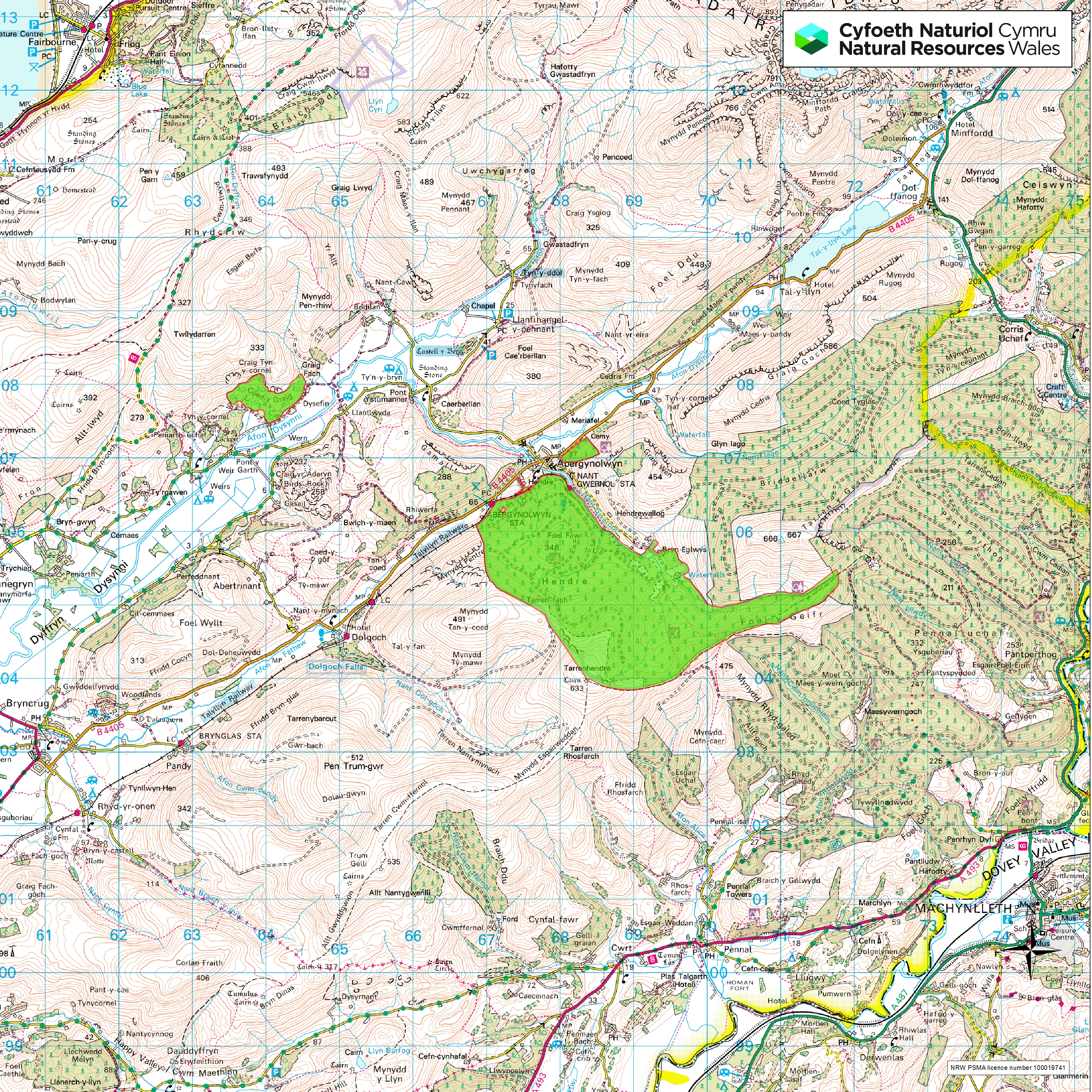
Abergynolwyn Forest Resource Plan (FRP) lies within the Tal-y-llyn and Dysynni valleys, located at the foot of Cadair Idris in southern end of Snowdonia National Park. These glacial valleys are characterised by dramatic mountainous views, with sparsely distributed settlements along the flat valley floor. The largest of these settlements is the village of Abergynolwyn, which sits at the northern edge of the main Abergynolwyn FRP forest block. The B4405 road runs in north-easterly direction along the base of the Tal-y-llyn valley, connecting the FRP to Tywyn on the west coast, and Dolgellau, the A487 and the A470 in the East.
The FRP includes the main Abergynolwyn forest block (596 ha), Cemetery block (10 ha) and Coed y Graig block (35 ha), which together total 641 ha of land. Cemetery block and the north-eastern face of the main Abergynolwyn block line the southern face of the steep glacial valley and sit prominently above Abergynolwyn village. From here the main Abergonolwyn block follows the course of the Nant Gwernol and Nant Llaeron, lining the northern faces of Foel Fawr, Tarrenhendre and Foel y Geifr, which sit above the old Bryn-Eglwys slate quarry. The Coed y Graig block is located roughly 3 km north-west of the other blocks, on the northern face of the Dysynni Valley.
The FRP is located at the western end of the vast Dyfi Forest, and as is characteristic within the Dyfi, the Abergynolwyn FRP blocks are predominantly coniferous. Although the main Abergynolwyn block is directly connected to the wider Dyfi Forest, the eastern end of this management block is demarked by the Foel y Geifr ridgeline, which sits in the mountain massif that lies between the villages of Abergonolwyn and Pantperthog. The Dyfi Biosphere also borders the southern end of the main Aberynolwyn block along this ridgeline. Other European protected sites within the vicinity of the FRP include the Cadair Idris SAC and Craig yr Aderyn SPA. The surrounding habitat of the FRP blocks consists of enclosed grazed farmland and open mountain, commercial conifer forest blocks, and smaller areas of mixed conifer/broadleaved woodlands on the lower slopes and riversides. Most of the FRP land is dedicated for open access on foot under the CRoW Act and also allows access for horse and cycles on a permissive basis.
97.9% of the Abergynolwyn FRP falls into the ‘Dysynni – upper and ‘Dysynni – lower’ river catchments, with the remainder within the ‘Fathew’, ‘Pennal’ and ‘Dulas North’ catchments. All of these catchments are classified as ‘Moderate’ or ‘Good’ under the Water FrameWork Directive assessment, although four of the five are also classified as failing acid sensitivity thresholds.
Summary of objectives
The following management objectives have been agreed in order to maintain and enhance the resilience of ecosystems, and the benefits they provide:
- Removal of larch and diversify the forest species composition to increase resilience to pests and diseases whilst building a robust forest for future generations.
- Continue to maintain a sustainable supply of timber production through the design of felling and restock species choice.
- Increased successional /riparian woodland areas for the improvement of habitat resilience and landscape scale habitat linkages.
- Identify and protect important heritage features and historic natural environment, which includes the recently designated Wales Slate World Heritage Site at Bryneglwys Slate Quarry and Talyllyn Railway.
- Continue to identify and restore ancient woodland site features and areas of conservation interest.
- Maintain and improve visitors experience by providing a safe and enjoyable diverse environment.
Maps
Map 2: Forest Management & Felling Strategy
Map 3: Forest Types & Restocking
Comments or feedback
If you have any comments or feedback, you can contact the Forest Resource Planning team at frp@naturalresourceswales.gov.uk.